For those who want to see exactly where the NASA Perseverance rover has been in its search for life on Mars, NASA has developed an interactive map. One of the many goals of the rover mission is to find ancient life on Mars. To do that, the rover will make quite a long journey across the Jezero Crater, covering different terrains and taking some incredible shots along the way.
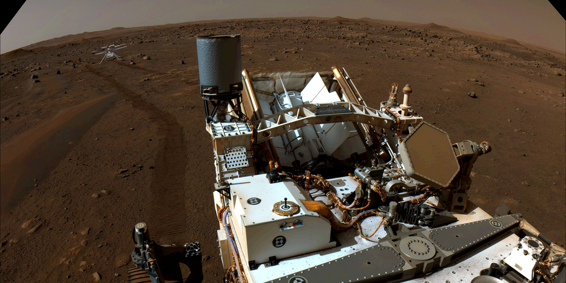
After landing on Mars and sitting in a sleep state for four months, the Perseverance rover began exploring the Red Planet and rolling across the seemingly lifeless landscape. Packed to the teeth with modern instruments for analyzing and studying the geography and geology of the surface, the rover is well-equipped to find signs of past life. These tools — aptly named SHERLOC and WATSON — enable the rover to collect significant data such as rock grain size, color, and different bonding agents within the geology. These tools use ultraviolet lasers and high-powered cameras to aid scientists back home on Earth in their research. Of course, Perseverance houses many other tools at its disposal for research.
Something that adds to the excitement of this new rover mission is NASA's new tool for tracking the rover's whereabouts. The potential of the beloved rover is put into perspective when the tool starts completely zoomed out displaying the 600km-wide view of the Mars surface. This multi-layered landscape image was taken by a combination of the HiRISE camera on the Mars Reconnaissance Orbiter and the European Space Agency Mars Express High-Resolution Stereo camera. From there, a little zooming in and the Perseverance's path becomes visible. The tool allows for layer selection, narrowing down the information displayed. Rover position, waypoints, and the path of Perseverance can be adjusted accordingly to narrow in on the information needed.
Gathering Data

When looking at the waypoints on the map, the Sol (Mars day) will be listed among the details on the top. Noticeably, the rover will hang out for a couple of Sols before moving on to the next position. NASA says "sometimes there are several days (Sols) worth of interesting science to do before moving on." With all the photos taken by the rover, as well as samples already collected for analysis, it makes sense that it'd take a few days before moving forward. So far the rover has driven 1.01 miles and is on Sol 157.
Another cool aspect of the map is the ability to track the Mars Helicopter's position and flight path. Knowing that the Mars Helicopter has already completed some incredible milestones, it's even cooler to be able to check the map and see exactly where it's been and on what day. The latest flight was on July 25 and had a peak altitude of 40 feet in the air, which is impressive for the groundbreaking helicopter. While it may not seem impressive, the fact that the helicopter has been able to accomplish this much is astounding. Overall, being able to track and see the exact path of the Perseverance and the Mars Helicopter is pretty incredible and something worth checking in on as time goes on.
Source: NASA