Google rolled out a wildfire layer on Android phones last week for Google Maps. In recent years, climate change has made wildfire season more severe, especially in states like California. This has led many companies to do what they can to help keep communities safe.
In 2019, Google piloted a wildfire boundary map in California that was released to the rest of the country in 2020. The feature was helpful for many, but it couldn't show more than one fire at a time. Since then, those in affected areas have been hoping for an update from Google Maps.
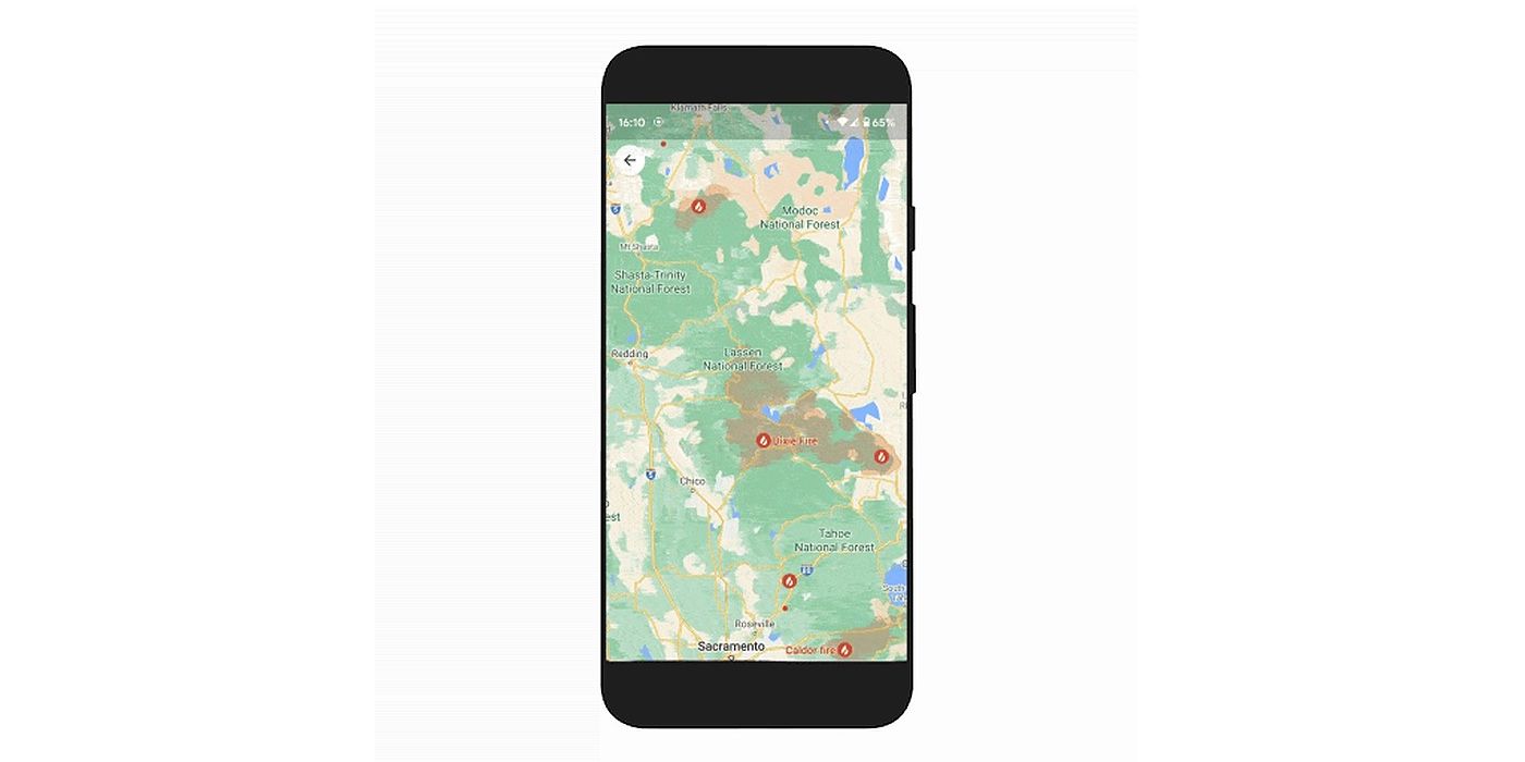
Now, Google has announced a new wildfire layer, which started rolling out on Android phones last week. iOS and desktop users will have access to it starting sometime in October. Google is working with the National Interagency Fire Center (NIFC) to display more fires, even small ones. In addition, the company plans on expanding data in other countries, starting with Australia.
How Does The Google Maps Wildfire Layer Work?
The app works by using data gathered by satellites, and then Google's geospatial analysis platform, Earth Engine, processes the information. The fires will appear on the map in red blotches and pins. These will indicate how far the fire has spread. Users can tap on the fire to see "important details about the fire, such as its containment, how many acres have burned, and when all this information was last reported." Resources also include evacuation details, phone numbers, and links to websites for emergency information. This will help residents stay up-to-date on wildfires and make informed decisions for action plans. However, as The Verge notes, the wildfire layer is limiting because it can only be updated when the device is connected to the internet. This will make it difficult when power lines go down. Google has yet to address this flaw.
The fire layer isn't the only new feature Google announced. It is expanding two more programs for Google Maps, the Tree Canopy tool and Address Maker. Tree Canopy is an expansion on Tree Canopy Lab launched in Los Angeles last year. This app enables governments to see what neighborhoods need more trees. Having more trees helps prevent heat-related injuries and deaths in areas most prone to heatwaves. The Tree Canopy feature will expand from 15 cities to more than 100, including Guadalajara, London, Sydney, and Toronto in 2022. Address Maker is an expansion on Plus Codes that was released in 2018. This program created street addresses in countries like India. Now, the company is bringing that to local rural areas. Address Maker uses Plus Codes to assign addresses to communities that don't have specific address structures. This program will make it easier for residents to apply for jobs and receive mail. All told, Google's updates seek to improve living for communities worldwide.


