Google Maps has rolled out more detailed mapping in four cities around the world. Users viewing New York, San Francisco, London, and Tokyo now see more mapping content and accuracy at street level. Google says the additions will help people to navigate more easily.
Google announced that it would be introducing more detailed and colorful mapping in August last year, another feature having begun being rolled out at the time. Color mapping now better reflects the geography of an area, with a new algorithmic technique interpreting high-definition satellite imagery to better reflect the colors of desert, lush green, and snowy areas, among others. Google points out that, while this can help users to get a better feel for an area, sometimes users simply need better information to help them get around.
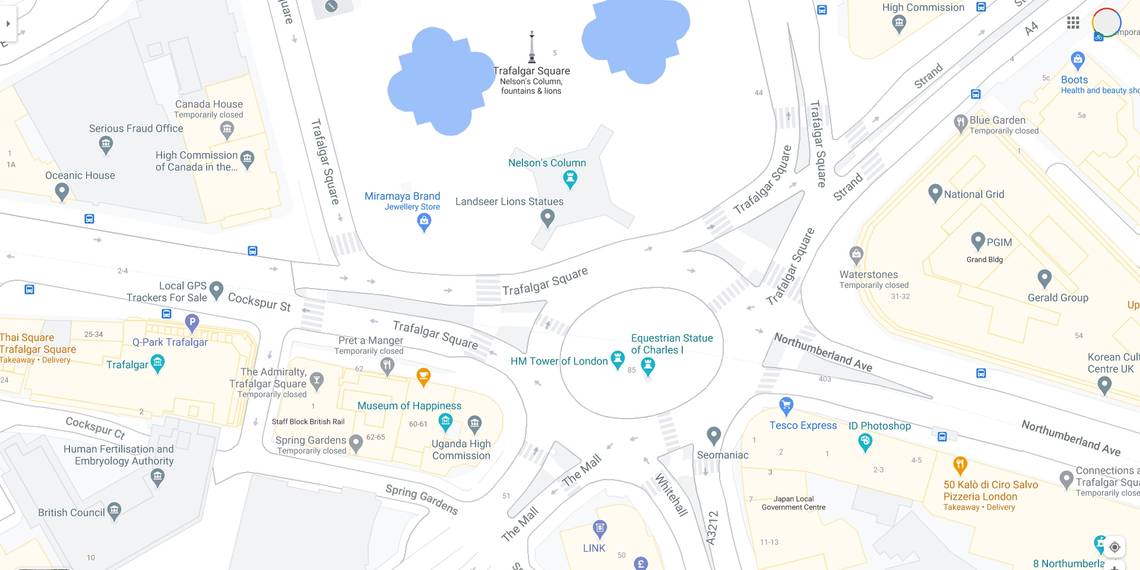
Perhaps most usefully, sidewalks and crosswalks have been added where previously Google Maps just showed streets as a whole. Similarly, medians and pedestrian islands in the center of streets are now shown, giving users an indication of crossing points. With this extra detail added, accurately-scaled road widths are now also displayed. Elsewhere, pathways and stairs in parks are now shown too.
How Do The New Google Maps Details Help?

Google explains that the additional mapping detail will help users to navigate more easily, allowing them to plan routes through cities that can be tricky to get around, especially when trying to cross busy roads. With this in mind, as Google points out, the updates will be most useful of all to those with accessibility needs. Planning a route through New York, for example, becomes more complicated when you add a wheelchair or a stroller into the equation and knowing where there are crosswalks and stairs can make that a lot easier.
These are by no means the only updates Google has made to Maps recently as it seeks to continually evolve the 15-year-old service to be ever-more useful. The recent addition of a community feed makes it easier to find local expert recommendations on activities, stores, and restaurants, while other updates have seen the addition of a COVID layer that provides information about case rates and checkpoints, and, also with COVID-19 in mind, the ability to see the crowdedness of public transport. A new Google Assistant driving mode, meanwhile, allows users to send and receive calls and messages, play media through a number of apps, and get directions all without looking at their phone.
Source: Google