Google recently revealed a brand new Immersive view for Maps that provides a more realistic look at different city locations. Google Maps has had a significant impact on the way people travel around the world and is often the first thing almost everyone checks before going to a new location. It has also become a daily morning ritual for office goers worldwide, using Google Maps to avoid traffic before heading out to work.
With each new major update, Maps keeps getting more powerful. In its current form, it is a competent tool that allows users to explore landmarks in three main map types - default, satellite, and terrain. Additionally, Maps also informs travelers about important details like public transport, traffic, bicycle routes, wildfires, and so on. COVID-19 information is another really helpful feature Google added in recent times to help people avoid virus hotspots. Of course, then there is Street View, which helps make it easier for people to find their way around town while walking.
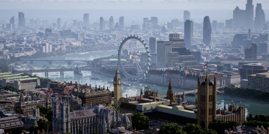
To further expand on Map’s amazing capabilities, Google recently announced a brand new ‘Immersive view’ mode for the app. It’ll seemingly allow users to explore a 3D version of the city on their smartphone. The experience of using Immersive view mode is akin to the camera angle on a flying drone. Users can move around the buildings or drop down to the street level to get a better view of the surroundings. According to Google, Immersive view will also display the indoor surroundings of any specific place like a restaurant, so users can scout the establishment virtually before booking a reservation. Immersive view will first roll out for San Francisco, New York, Los Angeles, London, and Tokyo, but support for more locations will follow.
How Google's Immersive View Works

Google is heavily relying on AI to make the Immersive view mode work. The 3D maps showcased within the mode are generated by an AI using a combination of satellite captures and street view shots. Buildings in Immersive view are also scaled to real-life versions so that the user can get a realistic look. Immersive View will also allow users to see how different landmarks, buildings, or places will look at different times of the day. It’ll also inform when a particular restaurant or park is most crowded, so users can better decide on when they want to visit a place.
In addition to Immersive view, Google also announced a new feature that enables users to find the most fuel-efficient route, as well as greater AR integration in third-party apps. Fuel-Efficient routing was recently launched in U.S. and Canada and is set to launch soon in Europe as well. The feature has enabled drivers to save half a million metric tons of carbon emissions already, Google claims, and should prove useful in helping EV owners to reduce range anxiety. In terms of the third-party AR app integration support, Google is making its Live View feature free for use by developers with the latest ARCore Geospatial API.
Source: Google