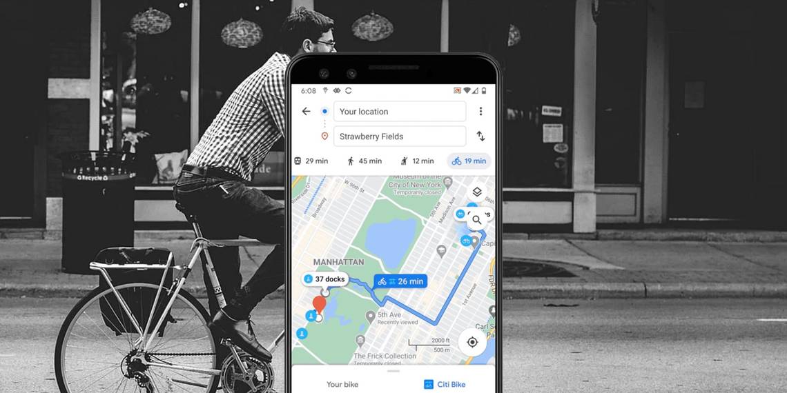
Google is rolling out a new bike-sharing information feature as part of its Google Maps bicycling route coverage. The feature means cyclists will be able to get directions when using rental bikes, with end-to-end navigation routes. This includes straightforward walking directions to the nearest bike station, directions between docking stations, and also walking directions to the final destination.
It has been more than 10 years since the biking directions were added to Google Maps and since then, the company has continually looked to refine and expand the way cyclists interact with Maps. With the latest feature additions, Google is now looking to equally appeal to casual cyclists, including those commuters who might be considering a way to break free from the busy public transport services, amid the COVID-19 pandemic. While there's been an increased demand for cycling information in general over the last few years, including for work, Google explains that the requests for cycling directions have climbed a whopping 69 percent in the last month, likely a result of virus outbreak.
To add more practicality to the Google Maps app for bike-sharing riders, Google Maps now offers more comprehensive information. This includes details on docked bike-share stations throughout a planned journey. In the announcement, Google also explains that in certain cities, Google Maps will offer direct links to bike-sharing services so that users can book or unlock a bike right from the app. The latest changes are rolling out first to ten cities over the next few months: Chicago, New York City, Rio De Janeiro, São Paulo, Taipei, Washington DC, San Francisco Bay Area, London, Mexico City, Montreal, and New Taipei City. While the list is currently limited, Google says it plans to add more cities in the future.
Getting Started With Google Maps Bike-Sharing

The main change here is the all-included route that Google now offers. For example, once the Google Maps app is launched and a start and end point of a journey selected, the app will automatically locate the nearest bike-sharing station to you. By tapping on the location, Google Maps will then generate the fastest walking route to get there, while also keeping the user updated on the number of available bikes at the docking station. Once the cyclist has a bicycle and begins the journey, Google Maps will highlight the docking station nearest to the final destination. Once there and the bicycle is docked again, Google Maps will then display the final leg of your route as walking directions.
As Google Maps has live bike availability for a variety of bike-sharing partners, users won't have to worry about being directed to a spot where there are no bikes available. However, the main takeaway here is the integration of all the information related to a single journey. That is, the ability to get to a bike-sharing station, pick one up, make the journey, and drop the bike off again, all through the Google Maps app.
Source: Google