Google Maps shows real-time traffic, making it easy to check for potential delays. The live traffic data incorporates anonymous information about the location and speed of vehicles, and then uses that information to display how busy traffic conditions are in real-time. To do this, Google Maps uses a color-code traffic map. Each street is denoted in either green, orange, or red to indicate various levels of traffic. Green indicates reasonably clear roads, orange signifies medium traffic, and red indicates highly congested streets.
Google Maps allows users to view live traffic data on both the Android and iOS apps. To see this, open up the Google Maps app and tap on the layers icon that looks like a stack of squares in the top-right corner of the app. A slide-out menu will pop out from the bottom of the phone's screen. To see live traffic data, select 'Traffic' from the list of available options and then close the menu by tapping on the 'x' in the top-right corner of the pop-up menu. The map will now show color-coded lines indicating the traffic status for all roads on the map. Users can now enter their destination and view the live traffic conditions and estimated travel time. Any toll prices will also be displayed for the route.
View Live Traffic On The Google Maps Website

Users can also check live traffic data on the Google Maps website. To do this, open Google Maps on any modern web browser, like Chrome, Firefox, Edge, or Safari. Once the target destination is opened on the map, hover the cursor over the layers icon in the bottom-left corner to expand the menu. The expanded menu will show a number of additional options, including Terrain, Transit, Traffic, and more. Click on 'Traffic' to see color-coded lines along all the roads on the map.
As with the app, green, orange and red will indicate the level of traffic on these roads, enabling users to gauge the traffic. To revert to the regular view, click on the 'Traffic' option once again. Apart from traffic conditions, Google Maps also displays crashes, construction, road closures, and incidents on a route. Users can tap on any of these icons to find out more information and decide if they need to take a different route.
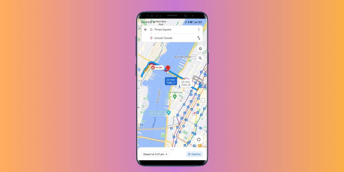
How To Check Traffic On Google Maps At Different Times

Google Maps has a handy feature that lets users check traffic at different times of the day. Say a user has a doctor's appointment in the evening, this feature lets them check the expected traffic at that particular time. This makes it easier to plan travel in advance. Google Maps uses historical traffic data to provide estimates, so while the actual travel time might differ, it gives users an idea of what to expect.
To check traffic at a different time, enter the destination on Google Maps and then tap 'Directions.' Now, tap on the three dots in the top right corner and select 'Set depart or arrive time.' Enter either the departure or arrival time, and tap 'Finished.' The map will display the estimated travel time with a 'Typically' disclaimer. Google Maps also lets users set a reminder to leave. To do this, tap the three dots in the top right and then 'Set a reminder to leave.' Google Maps will then send users a reminder for when they should leave, based on their selected arrival or departure time.
Source: Google